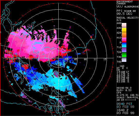
 This is doppler radar of wind speed in Canada.
skip to main |
skip to sidebar
Followers
Blog Archive
-
▼
2010
(50)
-
▼
July
(47)
- Statistical map
- Wind Rose
- Parallel coordinate graph
- Population Profile
- DLG
- Isopach
- Isopleth
- Isohyets
- Isotach
- DRG
- Index Value Plot
- DOQQ
- Lorenz Curve
- DEM
- Nominal area Choropleth Map
- Unclassified Choropleth
- Unstandardized Choropleth
- Standardized Choropleth
- Bivariate Choropleth
- Range Graded Proportional Circle
- Proportional Circle (Continous variable)
- Correlation Matrix
- Statistical Graph
- LIDAR
- Climograph
- Scatter Plot
- Box Plot
- Triangular plot
- Histogram
- Stem and Leaf plot
- Star plot
- Doppler Radar
- Black and White aerial photograph
- Animated Cartography
- cartographic
- Flow
- Isoline Map
- This is a really unique map that documents observa...
- Choropleth map
- Dot Distribution
- Propaganda
- PLSS
- Cadastral
- Thematic Map
- Topographic map
- Infrared Aerial Photo
- Isobar
-
▼
July
(47)

No comments:
Post a Comment